of Pakistan

|
of Pakistan |
|
Location, political and cultural history
The Islamic Republic of Pakistan is the most westerly fragment of former British Colonial India, bordering Iran and Afghanistan to its west, China to the north-east and India to the east.
The border with China, especially, is very mountainous. The Karakoram Range is now traversed by the highest paved international road in the world, rising to 4,693 metres (15,397 feet) above sea level. This route, part of the ancient Silk Road, has been open to the public since 1986, but the Karakoram mountains remain a barrier to cultural influences as well as an impediment to trade. With predominantly Hindu India to the east, Pakistan now tends to look in a generally westerly direction, towards Islamic neighbours, when seeking cultural empathy.
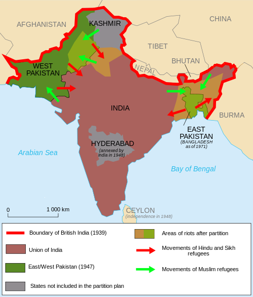
Following the Second World War, extensive decolonisation began worldwide. In 1947 the British left India, ending the British Raj (Raj is a Hindustani word meaning reign) that formally commenced in 1858 but traces even further back to the governance of the British East India Company which began in 1757.
Immediately before decolonisation, a partition arrangement was made that divided pre-1947 India along religious lines. That created West Pakistan, East Pakistan (both Islamic) and India (predominantly Hindu and Sikh). Huge migrations of population, not always peaceful, took place with an estimated 12½ million people displaced especially in the Punjab region. There remain a few Hindus and Christians in Pakistan, and relations are not always harmonious.
The two fragments of the original Pakistan formally separated in 1971, East Pakistan becoming Bangladesh and West Pakistan becoming The Islamic Republic of Pakistan. Border disputes with India continue, especially with respect to the state of Kashmir.
 |
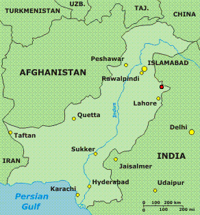 Above: Pakistan today (2012). The border with Kashmir is disputed. The location of Sialkot, an important centre for manufacture of surgical instruments, is identified by the red dot. |
|
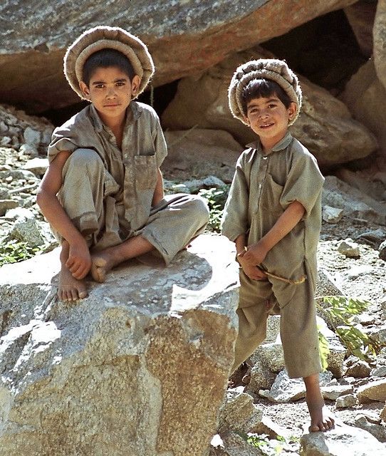
Circumcision is well-nigh universal in Pakistan, as would be expected. World Population Review gives the figure as 96.4% (there is still a small Hindu minority, and a smaller Christian one, in the country). As in many other Muslim countries boys were traditionally circumcised between the age of 5 and 10. However there now seems to be a growing trend towards neonatal circumcision, which has to be a positive move both from the health perspective and in terms of avoiding complications. Young Pakistani boys (courtesy Pinterest) Concomitant with this is a major move to manufacturing instruments for neonatal circumcision in the country - whether this is cause or effect is not clear. Sialkot is a major centre of surgical instrument manufacture, including the manufacture of circumcision clamps. The city, which is located close to the border with India, has a population of just over 1 million people (2011). The location is identified on the map above-right. Instruments include the Gomco, Mogen and Winkelmann clamps (see our Instruments and Techniques page |
Wikipedia
Maps courtesy of Wikipedia and the US Central Intelligence Agency.